Accessibility Options:
subjectId: 690540
visibleTabCount: 1
Sustainability Initiatives
United Nations Deelopment Program Sustainable Development Goals
#11 Sustainable Cities & Communities
Las Flores Mapeo Paricipativo, Barranaquilla Colombia
Auto documentation project of Lass Flores, one neighborhood in Barranquilla, Colombia intended as a tool to inform sustainable development. Project was initiated by University of Miami School of Architecture faculty Carie Penabad and Adib Cure, and implemented by Chris Mader and Tim Norris from the Insittute for Data Science and Computing at the Uniiversity of Miami.
Miami Dade County Zoning / Florida Building Codes
Florida Building Codes
Building, plumbing, residential, energy conservation, accessibility and more.
Miami Dade County Zoning Resources
Site-specific zoning data for properties in unincorporated Miami-Dade County is maintained by the Zoning section. Information available includes: the zoning of the site, the uses permitted within that zone and development parameters, such as the minimum lot size, the maximum density, the required setbacks from property lines, the maximum lot coverage and floor area ratio, the maximum height, parking and green area requirements.
Miami Dade Small Area Studies
PDF docs of completed charrette processes for various small areas in Miami Dade.
"Intelligent growth is the ideal for the community, as for the individual."
John Nolen. New Towns for Old: Achievements in Civic Improvement in Some Small Towns and Neighborhoods. 1927.
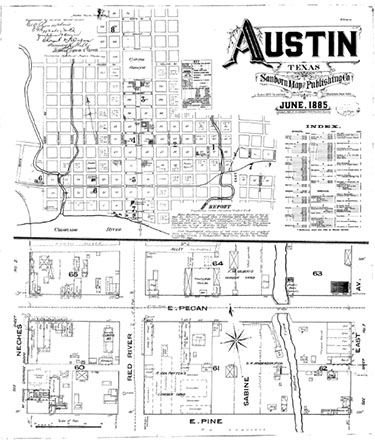 Map of Austin, Texas, 1885
 Geospatial Data
OpenGeoPortal (OGP)
Collaboratively developed, open source, federated web application to rapidly discover, preview, and retrieve geospatial data from multiple repositories in an effort to share resources and best practices in the areas of application development, metadata, data sharing, data licensing, and data sources in support of geospatial data repositories.
Collaboratively developed, open source, federated web application to rapidly discover, preview, and retrieve geospatial data from multiple repositories in an effort to share resources and best practices in the areas of application development, metadata, data sharing, data licensing, and data sources in support of geospatial data repositories.
E-Resources (Databases & Journals)
Sociological Abstracts
Sociological Abstracts indexes and abstracts research literature published worldwide in journals and other serial publications. Social Planning/Policy Development (SOPODA) is included as a subfile, providing additional literature on policy issues addressing violence, abuse, housing, the environment and other social issues.
Town Planning Review
TPR, the first academic journal devoted to Planning as a discipline, is a leading urban planning and regional planning journal providing a principal forum for communication between researchers and students, policy analysts and practitioners.
Urban Affairs Review
UAR is a peer-reviewed, bi-monthly journal focused on questions of politics, governance, and public policy specifically as they relate to cities and/or their regions.
Reports & Guidelines
Institute for Sustainable Communities. 2012. Better Plans for Better Places Report.
Maps & Gazeteers
Columbia Gazeteer of the World
Renowned geographic encyclopedia.
Digital Sanborn Maps
More than 660,000 Sanborn maps chart the growth and development of more than 12,000 American towns and cities. Sanborn maps are large-scale plans of a city or town, drawn at a scale of 50 feet to an inch. They were created to assist fire insurance companies as they assessed the risk associated with insuring a particular property. The maps list street blocks and building numbers including numbers in use at the time the map was made and previous numbers.
Library of Congress
Digital Collection with over 15,000 scanned maps.
NOAA Nautical Chart Locator
Perry-Castañeda Library Map Collection
University of Texas, Austin
Old Maps Online
A resouce combining over 400,000 digitized maps from collections all over the world.
United States Geological Survey
Over 100K modern and historic scanned topographic maps of the United States.
USGS Map Downloader